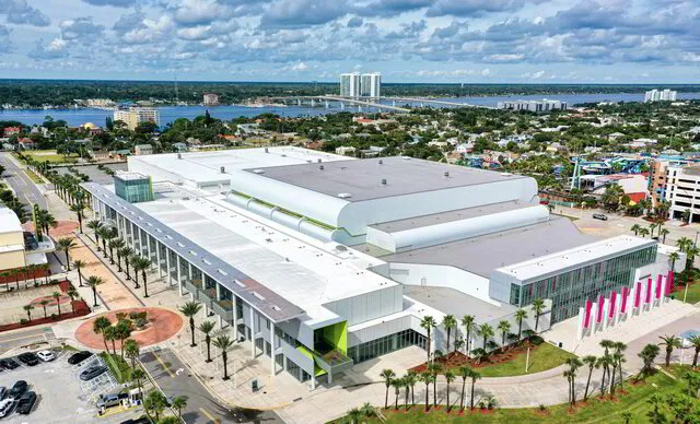
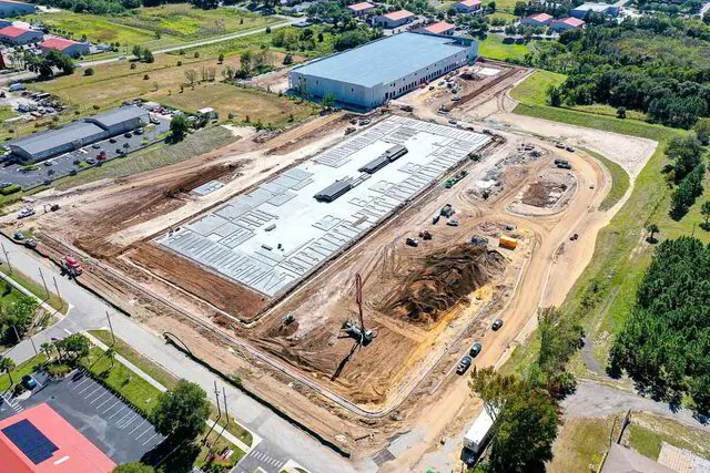
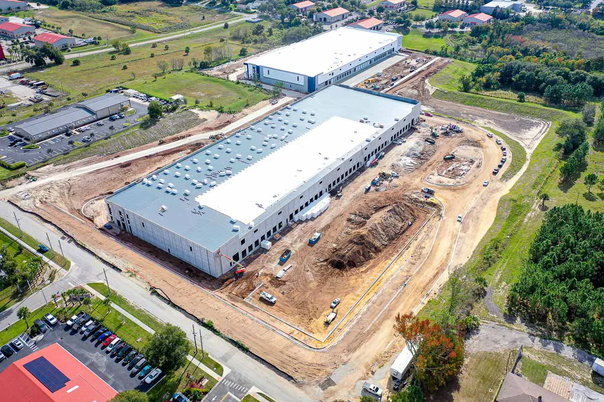
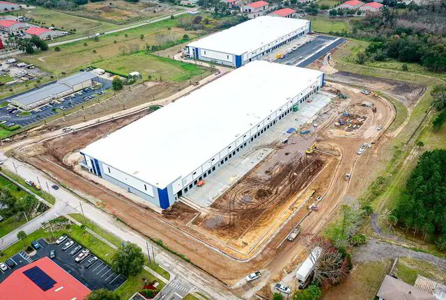
Precision Drone Photography for Real-Time Construction Site Analysis
Customized Drone Solutions for Land Development and Construction Projects in Central Florida
Our Trees to Keys Construction Progress Package means you have all the progress updates you need from start to finish – on time, every time.
Grueling Terrain and Large Projects are costly, labor-intensive, and can be unsafe to measure.
Are team members overwhelmed with having to take on additional work (and stress) by flying drones on construction sites and providing mapping information hoping to get it right?
How comfortable is your pilot flying a drone around a chaotic, crane-filled, concrete-mixing construction site, laden with magnetic interference that can cause signal loss between you and your drone?
Is it possible your team would love to hand their additional work off to a dedicated member, who not only handles all the pesky FAA stuff, but understands drone hardware and software?
Outside of mapping the sites, has your team consulted with marketing about start to finish drone photos and drone video documentation of construction?
Remember, drones are killer marketing tools as well!
It’s easy to miss opportunities when we’re overburdened and flying by the seat of our pants!
We eliminate the need to put team members in hard to reach areas and can cover hundreds of acres in just a few hours.
True North Drone Services provides the flight planning, drone data capture and collection, data processing, and reporting consistently and according to schedule.
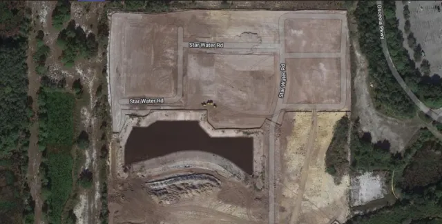
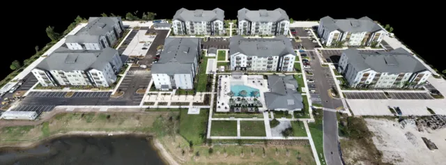
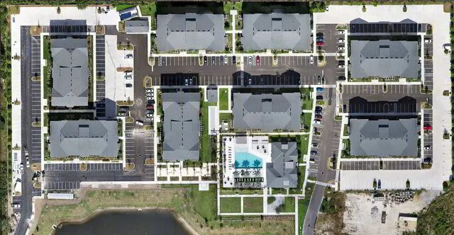
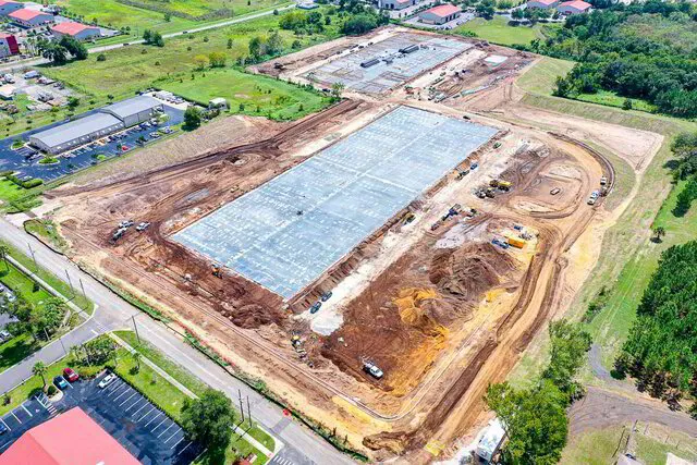
Our orthomosaic maps can be used to track progress, measure distance and area, and report the volume of a stockpile or how much land has been cleared.
We’re here to provide you with peace of mind and less stress when it comes to consistently collecting and processing construction site data.
If you want reliable drone mapping and aerial documentation weekly, bi-weekly, or monthly for your construction site, and want to keep your projects on track, on time, and without compromising the safety of your team, then book a free one on one call to see if we’re the right fit for your business.
You’ll feel confident knowing that you can complete your project safely, on-time, and within budget.
Phase 1
Flight Planning
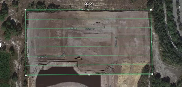
In this phase, we work with you to plan out our drone flight that will capture the mapping images of your job site.
Your Responsibilities:
- A 15-30 minute on-boarding call to discuss your current obstacles and expected deliverables - We’ll be quick, & to the point!
- A 10 Question On-boarding Form - We identify the project, create a safe flight plan in the correct location, and obtain any airspace authorizations that could potentially hold us back. We also discuss drone flight frequency, timeline, and whether ground control points will be used.
Our Responsibilities:
- Checking FAA Air Space and obtaining necessary authorizations (when available) - we do the work up front to make sure the air space we’re flying is legal and clear at the time of flight, every time.
- We’ll have uncomfortable conversations up front, understanding your time is precious. You’ll never have to worry if your site is legally flyable with a drone. If it’s in a No Fly Zone, which isn’t often but does happen, we’ll let you know ASAP.
- Setting Flight Date in accordance with the job site’s schedule - We’re easy. Let us know and we’ll be there!
- Creating a Flight Plan that will cover the area of the job site We certainly don’t want a map of half your site and half the adjacent cow pasture! We have accuracy checks in place to make sure we’ll only fly your site and nothing else.
What You Get:
- Confirmation of Air Space, Flight Date, & Schedule - You can check this portion of your project off the list and soak in satisfaction! The information you need will be provided accurately and on-time.
Phase 2
Drone Flight & Data Capture
In this phase, we travel to the job site, set up our drone, and fly the site.
Your Responsibilities:
- Provide Entry Access to Job Sites - Small sites are pretty easy to understand, but if it’s a large site with multiple entry points, help us out and if there’s a gate, please put us on the list.
- Provide Point of Contact while on-site We’ll need someone to communicate with prior to, during, and after the site visit.
- Notify Team Members we’ll be on-site flying a drone This is especially helpful when large machinery is onsite such as cranes, cement mixers, and dump trucks. We’ll stay out of their way, but it’s always better when everyone in the vicinity is aware of each other.
Our Responsibilities:
- Show up on-site at requested date & time - We show up prepared and ready to work.
- Wear proper PPE (Vest, Hardhat, Boots) Understanding of proper PPE on construction sites is crucial to the safety of ALL involved and we don’t take this lightly.
- Conduct Pre-Flight Safety Check of Drone We’ve checked to make sure we’re legal to fly, now it’s a matter of making sure our propellers are in good shape with no visible cracks, camera and gimbal work properly, and that our batteries are charged and not swollen.
- Flying the site, collecting Aerial Photos, Video, & Geo tagged drone photos based off the Flight Plan. We manually fly and carefully monitor each automated flight, making sure the drone is capturing the photos at the necessary intervals and flying in accordance with our pre-planned flight plan.
- Safely Land - Your Data made it home safe and sound!
- Check SD Card to make sure Data has been collected - We got it!
What You Get:
- We will communicate before and after the flight to let you know everything went well and according to plan or if there were any issues - Rest assured knowing the flight went according to plan and you’ll have your information soon!
Phase 3
Industry Standard Deliverables
In this phase, we will process the data taken from the drone flight and deliver the native images from the drone along with an Orthomosaic Map and 3D Model in the requested format.
Your Responsibilities:
- Provide Email Contact(s) to send the Drone Footage and Maps. Where to?
- What types of files are you looking for?
- Provide Ground Control Point Data from Surveyor (if using GCP) The surveyor control point measurements are what ties the real life data to the photos taken by the drone. It’s possible to achieve centimeter level accuracy with Post-Processing Kinematics (PPK) Drone Mapping and Ground Control Points
- Provide information on any Annotation or Measurement information (cut/fill, stockpile volume, etc) you would like to see Are you looking for a Stockpile Report or looking to see how much Muck has been cleared? Let us know and we’ll get you that report on the fly!
Our Responsibilities:
- Data transfer and upload to Dropbox for photos and videos. Mapping Software is used to stitch images together and create Measurable Orthomosaic. This is the Map Making Magic!
- Create Annotations and Provide Measurements
What You Get:
- Progress Update Photos of your site, Perimeter Drone Video, Native Geo Tagged Images, Measurable Orthomosaic Map/3D Model, and any requested Annotation or Measurement Reports You now have what you need to make informed decisions about your projects!
Why Use Drones to Monitor Site Progress?
Make Informed Decisions at Every Phase, Keeping Your Projects on Track and Within Budget.
Staying ahead is not a luxury in today’s bustling construction industry—it's a necessity.
True North Drone Services presents the Trees to Keys Construction Progress Package, a transformative solution designed exclusively for Construction Project Managers.
Hey, the future of your projects does NOT need to be dictated by outdated documentation methods. Not anymore.
Unparalleled Visibility: Say goodbye to incomplete site perspectives and project delays. With our aerial perspective, gain a comprehensive view of your construction site. No more second-guessing or costly surprises—just clarity, accuracy, and the power to proactively manage your projects.
Limited Data Inhibiting your Decision-making? Trees to Keys fills the gaps with high-resolution imagery and precise mapping. Make informed decisions at every phase, keeping projects on track and within budget.
Seamless Integration: We understand the apprehension about integrating new technology. True North Drone Services provides a smooth transition. Our Trees to Keys Construction Progress Package seamlessly integrates aerial data into your existing project management systems, enhancing, not disrupting, your operations.
Cost-Efficiency Redefined: Concerned about the investment? Think of it as an investment in efficiency. Trees to Keys empowers you to identify and address potential issues before they become costly problems.
The result after you've worked with us?
Significant time and cost savings that far outweigh the initial investment.
A large-scale project that previously required 15 hours of preparation time for AOC meetings can now be accomplished in just 2-3 hours, resulting in a time savings of approximately 80%.
Early issue identification and resolution can save a project an estimated 5-10% of its overall budget. For a million-dollar project, this equates to a cost savings of $50,000 to $100,000.
The construction landscape is evolving as technology rapidly evolves, and so should your approach in 2024.
Don't wait for costs and project overruns to escalate—take charge now. True North Drone Services is offering an exclusive opportunity for Central Florida Construction Project Managers to transform their project oversight.
Stay ahead of the competition, and hoist your construction game with Trees to Keys.
Why Drone Mapping is an effective way to collect and measure job site data
Safety
No more putting team members in dangerous or difficult to access areas such as steep slopes, high-rise buildings, and areas with hazardous materials.
Accuracy
We work with licensed surveyors to tie in precisely measured control points, achieving near centimeter level accuracy.
Speed & Efficiency
Avoid time in the field by flying over it, collecting a larger ground sample in less time.
5 Compelling Reasons Project Managers Choose True North Drone Services
In the competitive landscape of construction management, the power to make informed decisions and stay ahead is paramount. True North Drone Services stands as your strategic partner, offering a revolutionary approach to project oversight.
Here are 5 compelling reasons why Project Managers consistently choose us to elevate their construction game.
1. Expertise in Construction Aerial Solutions: True North Drone Services specializes exclusively in drone solutions tailored for the construction industry.
Our team combines extensive industry knowledge with cutting-edge technology to provide you with a comprehensive understanding of your project's progress, unmatched by traditional methods.
2. Trees to Keys Complete Construction Media Package: Step into the future of construction documentation with our exclusive Trees to Keys Construction Progress Package.
Weekly or bi-weekly site photos, dynamic video, and precision drone maps—this all-in-one solution empowers Project Managers with real-time insights, promoting efficient decision-making, and preventing costly delays.
3. Proven Efficiency and Cost Savings: Project Managers choose True North Drone Services for the proven efficiency and substantial cost savings our solutions deliver.
By proactively identifying issues and discrepancies, our services contribute to streamlined operations, keeping your projects on time and within budget.
4. Regulatory Compliance Assurance: Navigating regulatory requirements can be daunting. True North Drone Services alleviates this burden, providing compliant aerial monitoring solutions.
Trust us to keep your projects in line with all necessary FAA regulations, giving you peace of mind and a solid foundation for success.
5. Seamless Integration into Your Workflow: Worried about disruption during implementation? With True North Drone Services, integration is seamless.
Our team delivers a smooth transition, minimizing any learning curve, and maximizing the benefits of our solutions within your existing project management systems.
Take the Leap Toward Construction Excellence: Project Managers across Central Florida choose True North Drone Services not just for what we offer today, but for the transformative possibilities we bring to your construction projects. Improve your decision-making, streamline operations, and secure success from groundbreaking to completion. True North Drone Services is not just a service; it's your key to construction excellence.
Our Clients



YOUR NEXT STEPS
Ready To Get Started?
Reach out to us however you prefer! Either send us a message or book a free 1 on 1 call
